CAI Signposts
Distance
Difficulty
320, 320b
14.1km (8.76 miles)
hiking
D+
D-
Max Altitude
541 m (1774.93 ft.)
699 m (2293.31 ft.)
1045 m a.s.l. (3428.48 ft.)
Crossed protected areas
Park of Lucretili Mountains
……………………………. – Park of Lucretili Mountains
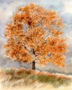
Watercolour by Giampiero Pierini

Walking along the mountain ridge for good part of this leg, one can enjoy a great panorama; in the last kilometers one will enter into the main path.
Following for a short stretch the provincial road towards Vallinfreda, we proceed up to the last houses of Orvinio and from there we take a cemented ramp on the right following the tracks of the Park signpost n° 320. After a short climb on a dirt road, you reach the provincial road leading to Percile, and you leave it a hundred meters ahead on the left. The dirt road goes up with curves; at a first important crossroads we continue on the right, on a white road and we follow it until we enter into the woods, reaching a small pass where there is a clearing on the left side.
From there the itinerary becomes a trail, and you will reach after a while the junction with the new path n° 320d leading to Percile, as it was set up during the works for the new Natural Path of the Parks.
One takes the left direction following the signpost 320 that will continue after the watershed for a long time drawing the ups and downs of the entire mountain ridge of Cimata delle Serre, first in the woods and then on wide pasture meadows. Left behind the hump of Cimata di Percile, near to the border of the Protected Area of Lucretili Mountains, we follow the path that loses height with several short turns until we reach a white road at around 920 m a.s.l. (approx 3018.37 ft.), as indicated by the Park signpost n° 320b.
We follow this road for a few turns heading South-East and then we leave it, taking the path that continues on the left. Passed a cistern of water, we continue on another dirt road that reaches the peak – first on a descent, then on a longer and gradual climb –, where there is a large water trough.
It follows another descent and then we enter into the village of Riofreddo.

