CAI Signposts
Distance
Difficulty
O8, O7
18.5 km (11.5 miles)
Hiking
D+
D-
Max Altitude
1021 m (3349.74 ft.)
624 m (2047.24 ft.)
1175 m a.s.l. (3854.99 ft.)
Crossed protected areas
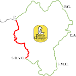
National Park of Abruzzi, Latium and Molise
…………………………. – National Park of Abruzzi, Latium and Molise
Watercolor by Giampiero Pierini

From Piazza della Libertà – in the village centre of San Donato Val di Comino, where you can also park – we start walking along Via Napoli towards South-East for about 200-300 metres (656- 984 ft.), then we take Via Chiaie, which branches off at the left. At a small farmhouse the road –asphalted for the first tract – turns to a dirt road. Continuing on the same road for about 2 km (1.243 miles) with ups and downs and then on a slight slope, we flank a clean foothill strip, with scattered houses, olive groves and meadows with fruit trees. The whole section keeps heading South-East.
A little further after entering an oak wood, and near the lower part of the Fischia Valley, the white road begins then to climb up the watershed along the left orographic side approaching the valley bottom, which is wide in this part because of its morphology (alluvial fan).
Clearings alternating with wooded stretches, the valley loses its amplitude and mixed wood gives way to beech forest. There is also an alternation of slopes and the dirt road fades away, especially when crossing meadows.
In the last 600 m before reaching a drinking trough, the dirt road has many curves that produce a great change in elevation. From there, the road continues heading S-SSW up to the junction with the main road that goes up the Fischia Valley from Settefrati. A park signpost indicates the intersection of the O7 and the O8 paths.
Taking the descent, to the right, after a few hundred metres you come out of the woodland and after skirting and following three alternating valleys, in about 2 more km (1.243 miles) you reach the village of Settefrati.
The second part of the step continues on the new Park’s path marked with signpost O7, which retraces an already existing local thematic path. If the first part up to the pass is characterized by bushy meadows and small groves, the descent towards the end of the step instead (where there is the Shrine of Madonna di Val Canneto) is completely immersed into the beech forest, also due to the different exposure of this slope.