CAI Signposts
Distance
Difficulty
VL10
18.8 km (11.68 miles)
Intense hiking
D+
D-
Max Altitude
925 m (3034.78 ft.)
830 m (2723.1 ft.)
1750 m a.s.l. (5741.47 ft.)
Crossed protected areas
………………………….. – Mountain Range of Serra Lunga
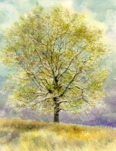
Watercolour by Giampiero Pierini
Taking the trail at the height of the important source/wash-house – on one side of Piazzale Zarthmann, after a few turns and a narrow border road flanking the meadows – the path enters into the wood and it crosses the white road going from Civita d’Antino up to the wide slope of this watershed chain between the Roveto Valley, the Collelongo Valley and Villavallelonga (in the Marsica area) with a right diagonal line on a rather steep slope.
In the upper part, crossing with a diagonal line the beautiful beech forest, one reaches high altitude pasture meadows, where we can also find a big watering trough (photo). The view on the valley is majestic and ranges over the awesome peaks of Pizzo Deta (Ernici Mountains) and Mount Viglio (Càntari Mountains), which close westbound the side valley of Morino and Rendinara through a very suggestive amphitheatre. Furthermore, if the season is favourable, the high waterfall of the Zompo Lo Schioppo Reserve is really amazing.
Just above the big watering trough, heading East, we reach the Mountain Hut of Civita d’Antino, managed by the Italian Alpine Club of the Roveto Valley, and we join again the white road we left before. Continuing on the same road for one or two kilometres, where we can see a drinking trough on the watershed ridge of Serra Lunga, one starts to descend down to the north-eastern slope along a dirt mule track, surrounded by a unique beech wood.
After a while, one proceeds along the path down to the bushy meadows of a valley floor, not distant from the watershed, heading almost East. Then you will walk again on a dirt road, allowing you to reach the church, with a few kilometres of walk, before arriving at the Church of Madonna a Monte and beyond, at the inhabited area of Collelongo.
Left behind Via Aia dei Lupi along the provincial road heading to Villavallelonga, one leaves the asphalted road to the right, continuing on a dirt road. One walks on paths with several ups and downs heading East-Southeast and you will arrive close to the village at the end of the step.

